
2025 Hike Reports
Wednesday, April 23, 2025
Location: Durham Mine Trails
Rating: Moderate
Distance: 5 miles
Elevation Gain: 600'
Pace: Standard
Join us for this beautiful loop hike and hopefully get a peek at some spring wildflowers, including pink lady slippers.
Need $5 exact for parking or a GA parks annual pass.
Arrive around 8:50 a.m. We begin hiking at 9.
Link to location on Google.
Contact Jenny at jenhop60@gmail.com to sign up.
Wednesday, April 16, 2025
Location: Lula Lake Land Trust's Durham Mine Trail.
Distance: 5 - 7 miles
Arrive in time to be ready to hike promptly at 9 a.m.
Need $5 exact for parking, or a GA parks annual pass, or a LLLT annual pass.
NOTE: this same hike is already on the schedule for Wednesday 4/23, but throwing in a last-minute addition for those who may not make it next week and/or rain.
Contact Jenny at jenhop60@gmail.com to sign up.
Sunday, April 13
Durham Mine Trails on Lookout Mountain
Miles: 7.0
Elevation gain: approx. 900'
Rating: Moderately strenuous
Pace: Standard
Hike Leader: Jenny Hopkins
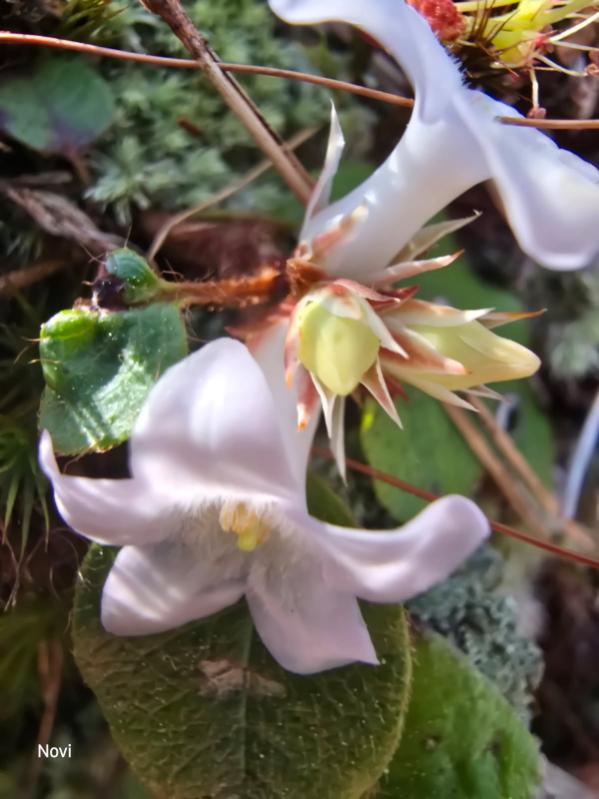
This trail system owned by Lula Lake Land Trust has some 14 miles of trails, but we'll hike only a portion and hopefully see a large patch of pink lady slippers, at least in the early stages of bloom. Need $5 exact for parking, or a GA parks annual pass, or LLLT annual pass.
Contact Jenny at jenhop60@gmail.com to sign up.
Durham Mine Trails on Lookout Mountain
Miles: 7.0
Elevation gain: approx. 900'
Rating: Moderately strenuous
Pace: Standard
Hike Leader: Jenny Hopkins
This trail system owned by Lula Lake Land Trust has some 14 miles of trails, but we'll hike only a portion and hopefully see a large patch of pink lady slippers, at least in the early stages of bloom. Need $5 exact for parking, or a GA parks annual pass, or LLLT annual pass.
Contact Jenny at jenhop60@gmail.com to sign up.
Saturday, April 12, 2025
Virgin Falls, Sparta TN
Location: Virgin Falls State Natural Area
Driving Time: 1 hour 45 minutes from Chattanooga
Distance: 9+ miles including 8.4 mile lollipop loop and a couple short side trails
Rating: Strenuous Elevation: 1000+ ft. (up on the way out)
Pace: Standard
Trail Conditions: Rocky, uneven at times, cable crossing.
Our annual Virgin Falls hike is coming up. Explore the beautiful and mystical Virgin Falls on this strenuous 9+ mile journey. Depending on water level, there are three other falls: Big Branch, Big Laurel and Sheep Cave. Virgin Falls seems to originate and disappear with no visible water source though we’ll hike up and around to peek into its subterranean source: a cool (literally and figuratively) cave on top. This is one of the best rated hikes in Tennessee but make a note that it is strenuous so please be prepared. Estimating at least 6- 7 hours of hiking with lunch at fall
|
|
Wednesday, April 10-12, 2025 Location: Lula Lake Land Trust Rating: Moderate Distance: 6 miles Elevation Gain: 900' From hike to Smokies and the Old Settler’s Trail by CHC map markers and those who helped with shuttle. |
Wednesday, April 9, 2025
Location: Lula Lake Land Trust
Rating: Moderate
Distance: 6 miles
Elevation Gain: 900'
Club members have special access to Lula Lake Land Trust's core preserve.
Must contact Jenny at jenhop60@gmail.com for details.
Location: Lula Lake Land Trust
Rating: Moderate
Distance: 6 miles
Elevation Gain: 900'
Club members have special access to Lula Lake Land Trust's core preserve.
Must contact Jenny at jenhop60@gmail.com for details.
Saturday, April 5, 2025
Location: Walden’s Ridge (Near Red Bank)
Popup hike
Rating: Easy/Moderate
Distance: 5 miles, Loop
This is a loop hike with moderate switchback climb for about a mile and a half then flat across ridge to moderate switchback down. We’ll start early and should take about two hours or less. Contact me for more information or to join.
Saturday, March 29th
Flipper Bend Trail
Location: Southern Corner of North Chickamauga Creek Gorge State Park, just south of Soddy-Daisy
Driving Time: 20 min from downtown
Distance: 9 miles
Elevation Gain: 500 Ft
Rating: Easy to Moderate
Pace: Standard
Hike Leader: Dan Garner
This is a mostly easy 9 mi hike through the woods, with a few 100-150ft climbs. The trail is mostly well maintained, but needs improvement in its markings and signage. I found good cell coverage during the hike and the trail is well depicted on my Apple phone maps. A few muddy spots, so if there are heavy rains the week before it will be postponed. The loop section hike goes along the bluff lines of the gorge, offering a variety of views of the gorge and the valley.
Hike leader report:
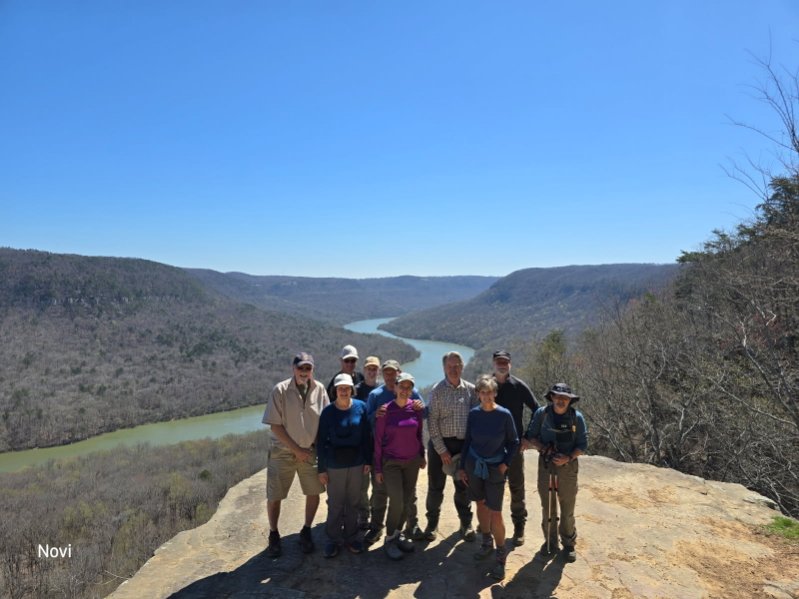
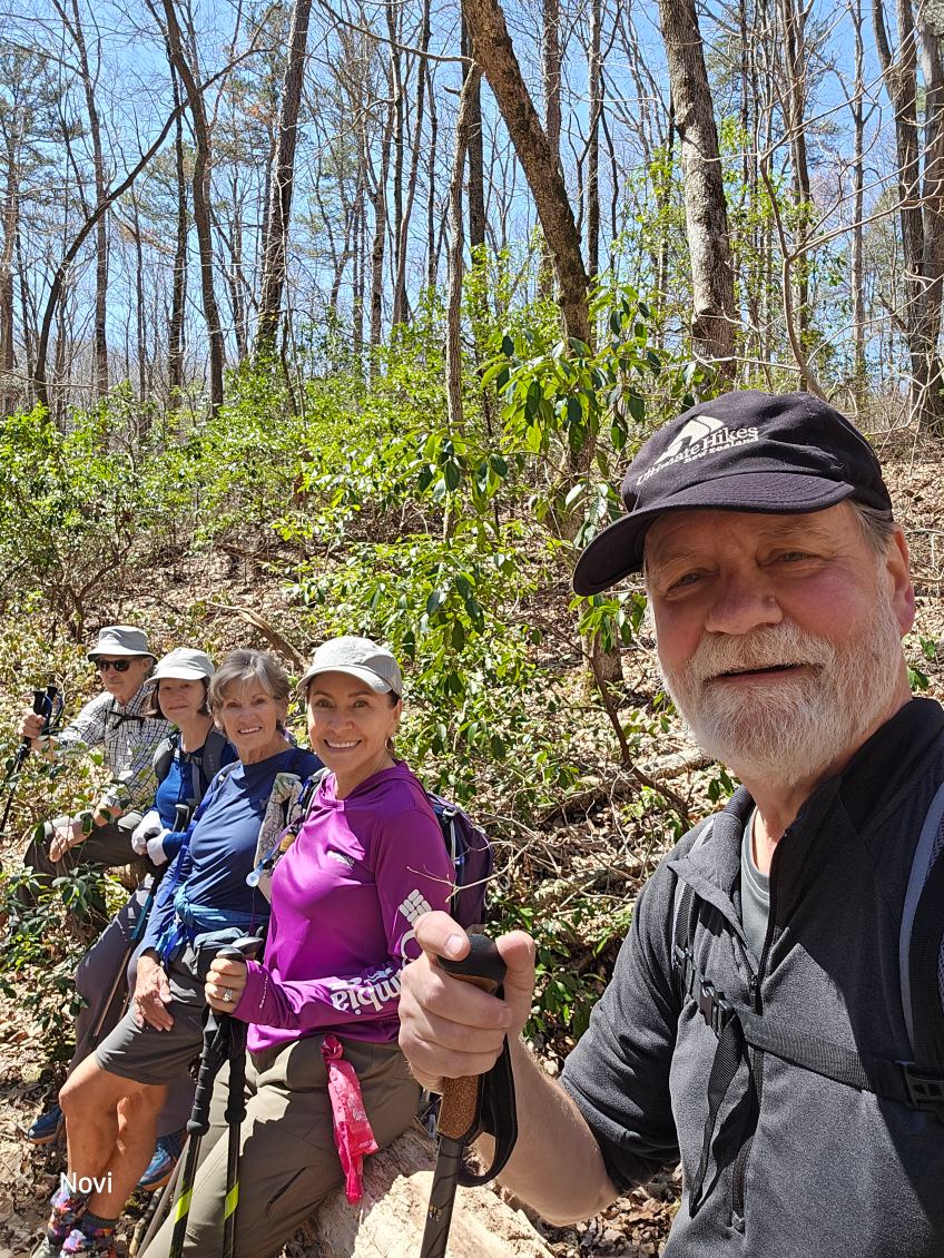
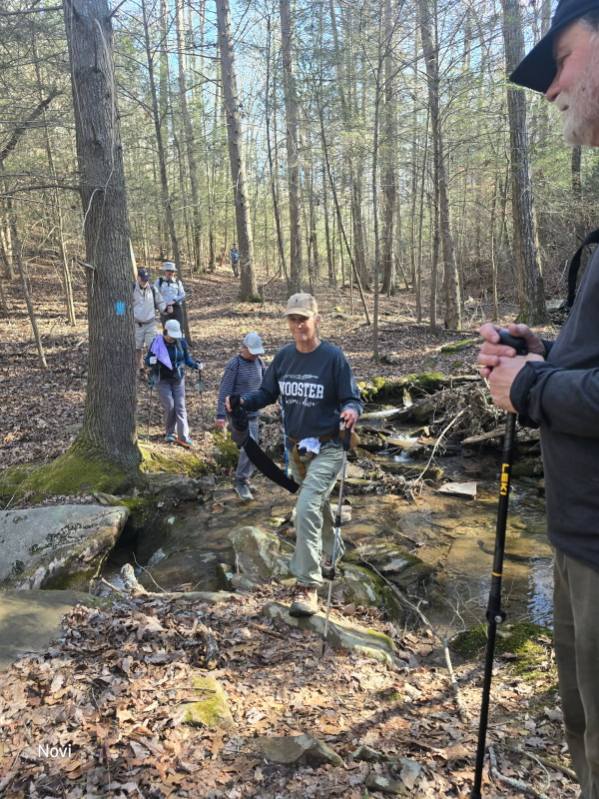
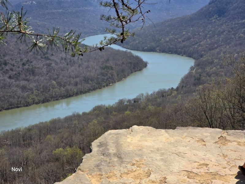
Eight members of the Club, led by Dan Garner, hiked the Flipper Bend trail at the far northeast end of Signal Mountain on March 29. This trail travels the bluff along the west wall of the North Chickamauga Creek Gorge, opposite Mowbray Mountain. It has no connection to the Cumberland Trail nor any other known trails in the area. The hike lasted 4 hours. This is a little known trail; even with all the hikers having a lot of experience in this area, no one but the leader had ever been on the trail before. Also, in nearly 4 hours of hiking only 3 other hikers were met on the trail, more evidence of how infrequently this nice trail actually is used. Conditions were cloudy, but the rain never showed up until later in the afternoon. This trail affords a beautiful vista of the mouth of the gorge, Middle Valley, and Dallas Bay.
Flipper Bend Trail
Location: Southern Corner of North Chickamauga Creek Gorge State Park, just south of Soddy-Daisy
Driving Time: 20 min from downtown
Distance: 9 miles
Elevation Gain: 500 Ft
Rating: Easy to Moderate
Pace: Standard
Hike Leader: Dan Garner
This is a mostly easy 9 mi hike through the woods, with a few 100-150ft climbs. The trail is mostly well maintained, but needs improvement in its markings and signage. I found good cell coverage during the hike and the trail is well depicted on my Apple phone maps. A few muddy spots, so if there are heavy rains the week before it will be postponed. The loop section hike goes along the bluff lines of the gorge, offering a variety of views of the gorge and the valley.
Hike leader report:
Eight members of the Club, led by Dan Garner, hiked the Flipper Bend trail at the far northeast end of Signal Mountain on March 29. This trail travels the bluff along the west wall of the North Chickamauga Creek Gorge, opposite Mowbray Mountain. It has no connection to the Cumberland Trail nor any other known trails in the area. The hike lasted 4 hours. This is a little known trail; even with all the hikers having a lot of experience in this area, no one but the leader had ever been on the trail before. Also, in nearly 4 hours of hiking only 3 other hikers were met on the trail, more evidence of how infrequently this nice trail actually is used. Conditions were cloudy, but the rain never showed up until later in the afternoon. This trail affords a beautiful vista of the mouth of the gorge, Middle Valley, and Dallas Bay.
Walls of Jericho Wednesday March 26
With the promise of perfect weather, water falls and the possibility of blue bells in bloom - 23 of us set out on the Walls of Jericho Trail (Alabama). Debbie, leading the pack, says she can't remember how many times she's led this hike over the years - but it seems she has perfected the timing of the blooming blue bells - What a site to see!!! 🥰
We took time to smell the flowers then continued on to explore a crawl cave, visit the Clark Family Cemetery dated late 1800's and take pictures inside a tree, literally! Our grand finale was our water crossing to the Falls, where we enjoyed lunch and then turned around for our trek back.
Approximately 8 miles; 1,400 elevation
Saturday, March 22nd
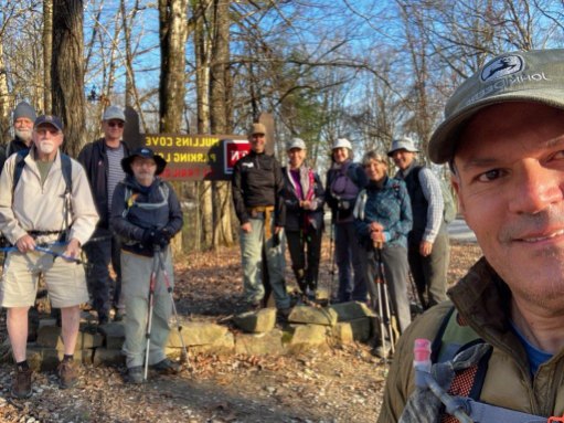
Mullen’s Cove Loop
The second day of spring brought in perfect weather for a nearly 10-mile trek along Mullens Cove Loop (counterclockwise). With Debbie leading the way, the sun warming our backs and the soothing sound of running water accompanying our steps -we all enjoyed the journey to Short Creek, then Mullens Creek - stopping to break at Mullens Cove overlook. We then rock hopped across Hemlock Branch and on towards Snoopers Rock, where we all enjoyed lunch with a breathtaking view of the TN River. From there we finished off by hiking to Indian Rockhouse and back to our vehicles. Though wildflowers were scarce along the path, we were lucky to catch glimpses of a few - (Trailing Arbutus, Yellow Violets, Anemone and Star Chickweed) - hinting at the beginning of Spring 🥰
|
|
|
|
|
|
|
|
|
Wednesday, March 12 Hike Report
It was a most beautiful day for a hike! Twelve of us hiked 9 miles on the Cumberland Trail beginning at the Hall Road trailhead on Signal Mountain. Blue skies and comfortable temperatures greeted us, along with a special send off by Che Carico. We hiked 4.5 miles to Seed Tick Branch where we had lunch and then returned to the trailhead. Everyone enjoyed being in the woods and the hike along the N Chickamauga Creek was invigorating. Just what we needed!
Those hiking were Charlie Breeding, Joyce Campbell, Greg Clark, Jack Flack, Jenny Hopkins, Shelly Lewis, Bill Ragsdale, Sarah Schlegel, Bob Shafto, Joe Teringer, Bob Wood and hike leader, Debbie Lambert.